The stratigraphies in Domus.Cad

Stratigraphies describe the composition of a wall, floor or roof, dividing it into components, i.e. strata.   The strata Through the Strata command from the Modify menu, the dialogue window for defining the preferred strata opens. Each stratum is defined by a series of descriptive, graphical and numerical parameters: The name of the stratum The 3D material The color and the…

Domus.Cad Pro 22.02 – Differences From 22.0.1

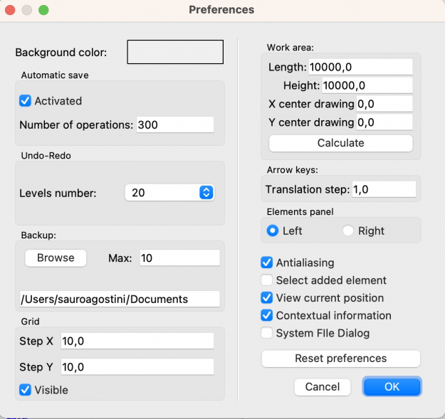
Undo-Redo management Until the previous version, the number of Undo-Redo operations was unlimited, i.e. it was possible to undo and eventually redo an indefinite number of operations. Each operation is kept in memory to be subsequently cancelled, this for complex projects can lead, as the work proceeds, to a memory occupation which can slow down…

Door-to-door sales tecniques

Back in the sixties, a company called Gorlier devised a marketing technique destined to become famous and much imitated.

It was based on the idea of giving their encyclopaedias away free, instead of selling them.  The salesman would tell you the encyclopaedia was being offered to you free-of-charge, in return for your endorsement of the product, to be used in a future advertising campaign.  Great!  “I’ll take them”, said everyone, but – and, of course, there had to be a ‘but’!

Convert, view and print DWG, DXF and DWF

Interstudio released CAD File Converter, a program to convert, view and print DWG, DXF and DWF files, supporting all the format 12 … 2011.

CAD File Converter is the key that gives you access to drawings in the most common CAD formats, by making them compatible with your own graphic programmes – even if not the latest versions – visualising them and printing in PDF format.

Main functions are:

What’s new in land modelling

Version 10 of Nonio C, a program for land modeling and 3D display, was released.Major novelties include:  New interactive modeling function, using mouse to move selected points vertically or horizontally. All windows, contours, colors, sections and 3D views are updated real time. > Breaklines introduced by mouse intervene immediately on terrain , canceling old triangles…