


Architecture in the cloud (of points)

DigiCad 3D è un programma di fotogrammetria architettonica, aerea, satellitare e di cartografia. In realtà si suoi utilizzi pratici non si limitano solo a questo, viene utilizzato in archeologia, ricostruzioni di incidenti, confini e molto altro.
In tutti questi usi una caratteristica comune è quella di referenziare o geo-referenziare delle immagini di vario tipo per ottenere un risultato perfettamente misurabile.
Immagini multiple possono essere mosaica in modo preciso in base ad informazioni certe di riferimento assoluto.
In DigiCad 3D le immagini possono anche essere scollegate tra loro, possono mancare delle parti che semplicemente rimangono bianche, perché magari qualche cosa fa loro ombra.
The image cropping functions are also very important, it is about precision vector cropping that allows to cut out extraneous parts, to superimpose different images and details and more.
Following are the various referencing methods used by DigiCad 3D.
Measured points
It is the basis for DigiCad 3D, 4 points measured in any way are connected to the corresponding points.
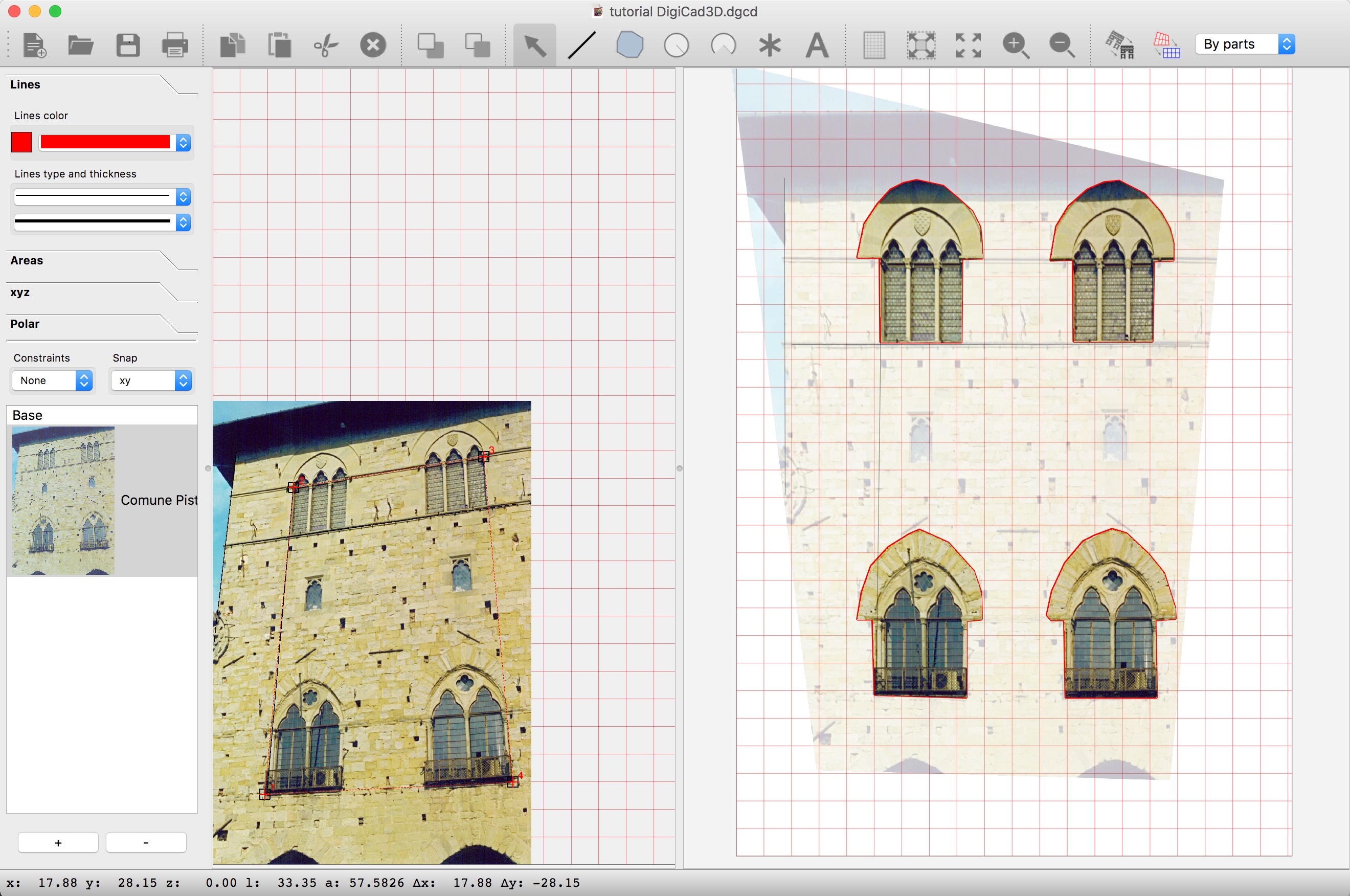
In the case of mosaicage, the measured points are more than 4, but if the measurements are related to a common origin, there is no loss of precision.
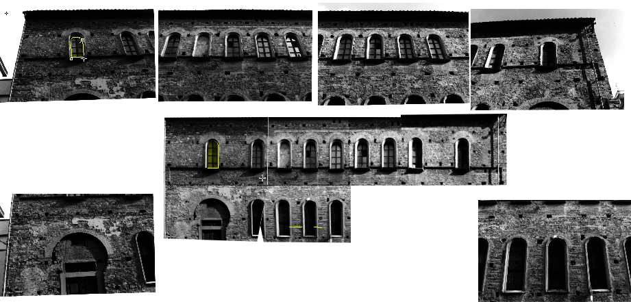
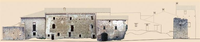
Below the mosaic of a church where the various parts are straightened and positioned according to a series of measurements referring to the left corner of the building.
For complex situations the points can also be measured with a topographic instrument, as in the following images:

The Church_Mesh example, provided with the program, is also used.
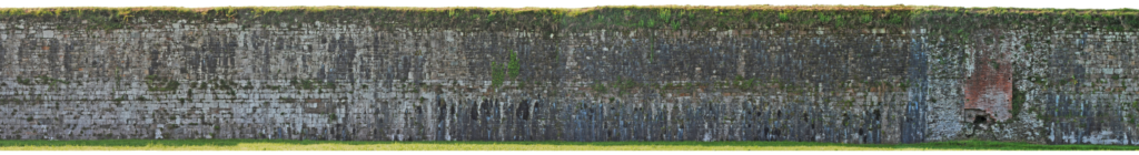
In the following picture is illustrated a work on the city-walls of Lucca, where the sequence of photos is as long as the entire wall, some kilometers..
Drawing as a basis
Another way is to import a drawing as the basis for referencing images. For example I can import a drawing in DWG and DXF and use it to map the homologous points between drawing and images.
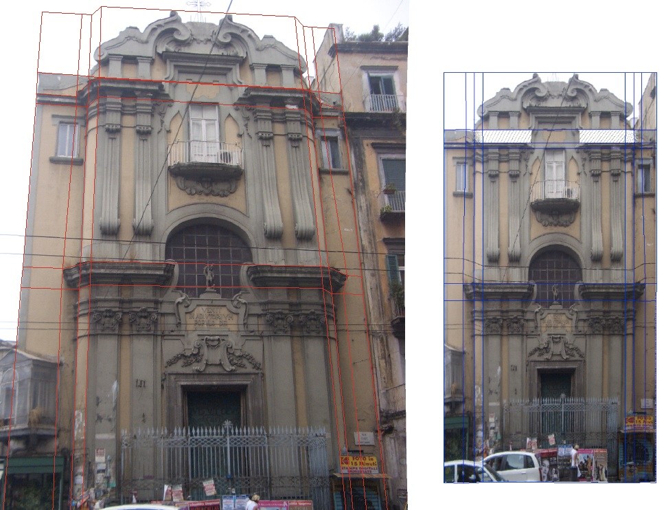
In the following picture three images are superimposed and referenced to the imported DWG drawing:

In the following picture the images are superimposed on the drawing below and cut out according to the forms of the ruins below
In the following image, instead, a drone photo of a castle is superimposed on a drawing from the 1920s, in an archaeological work by the Institute of Topography and History of the Scuola Normale of Pisa.

In the following image we see a mosaic of non-overlapping images that use the imported design to be transformed and placed exactly inside the arches.
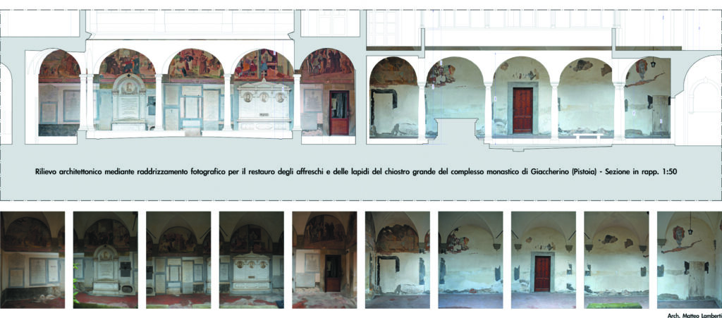
Image as a basis
Images can also be used as a basis for referencing or georeferencing other images.Anche le immagini possono essere usate come base per referenziare o georeferenziare altre immagini.
For example, images of particular shots with a telephoto lens can be superimposed exactly on the general images taken with a wide angle, or images not visible from the general image because elements cover part of the main image, due to the presence of trees, heavy vehicles or other.I
Images on maps or charts
In the following picture an aerial photo from a drone is superimposed on a cadastral map. On the left is visible the aerial photo and on the right the cadastral map with transformed photo and geo-referenced based on 4 homologous points.
The same aerial photo superimposed on a perfectly scaled satellite image. The satellite image is obtained with the Map2Cad function, which imports maps directly from google data base with real measurements.
Point Cloud
It is possible to import point clouds and create perspective views and axonometries, elevation plans and sections. In this case all results are real measurements and can be used to geo-reference photos,
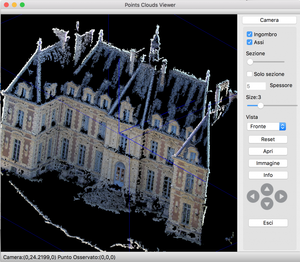
The management of point clouds in DigiCad 3D is a basic management, useful for integration with photos. For advanced point cloud management, Domus.Cad. is preferred
Other useful tools
All the operations described above are made more complete by a series of image tools, including:
- Management of image transparency
- Crop images with vector figures such as polygons, circles etc.
- Control of transparency
- Automatic vectorization
- Brightness and contrast control
- Correction of optical distortion of lenses
Download and try DigiCad 3D 25 >
DigiCad 3D 25 launch offer
Buy DigiCad 3D Rent to own 135 € or 135 USD
Buy DigiCad 3D Unlimited 390 € or 390 USD
Other information
DigiCad 3D 25 – New functionalities
DigiCad 3D 24 – New functionalities
Digicad 3D 23; The new version
digicad-3d –innovation in photogrammetry and-cartography
Related posts


