DigiCad 3D is an architectural and aerial photogrammetry, cartography and mapping program born in 1987 and continuously renewed to follow the developments of the technique. We started from graphics tablets and large digitizers to get to drones and the future is not over yet.
To better meet new needs and new technological challenges, the program has been completely rewritten, both as a user interface and as an analytical code, using a cross-platform development system with advanced features and including new software technologies.
Differences from previous versions
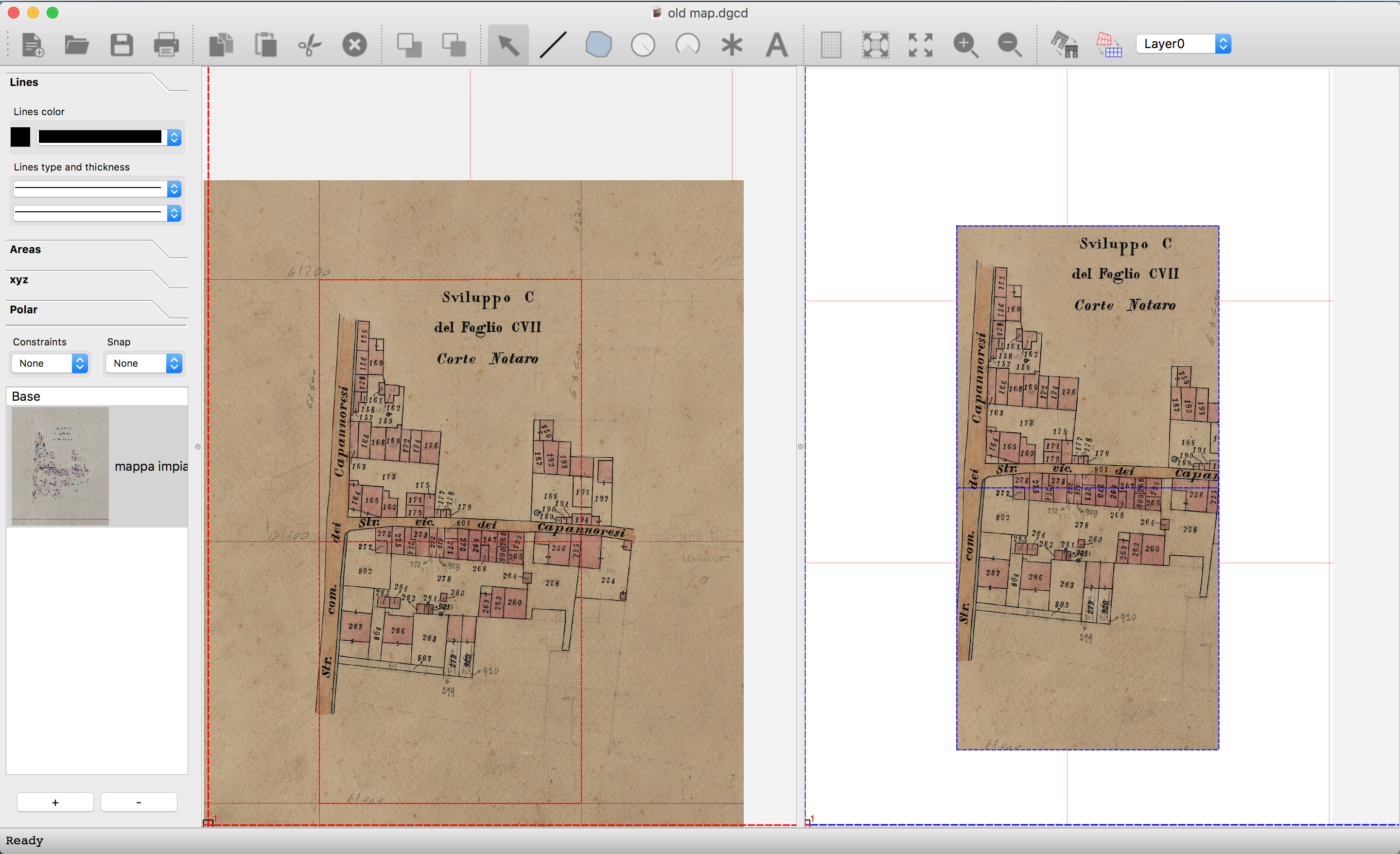
Referring to previous versions of the program, the first immediate difference is the appearance of the user interface, with the work window divided into two parts, the source window and the target window, an inspection panel on the left and a tool bar at the top.
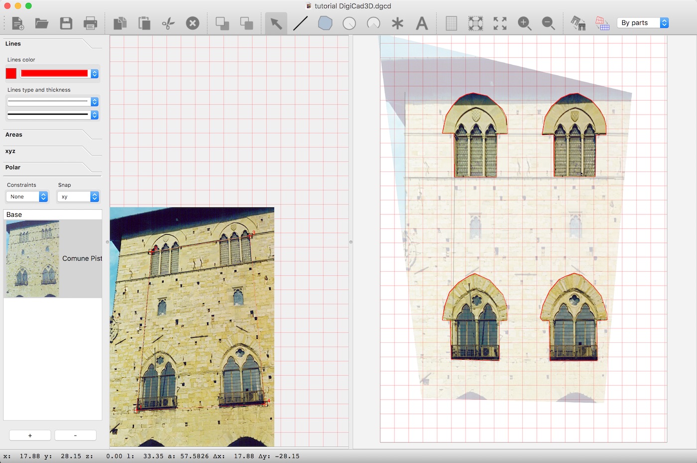
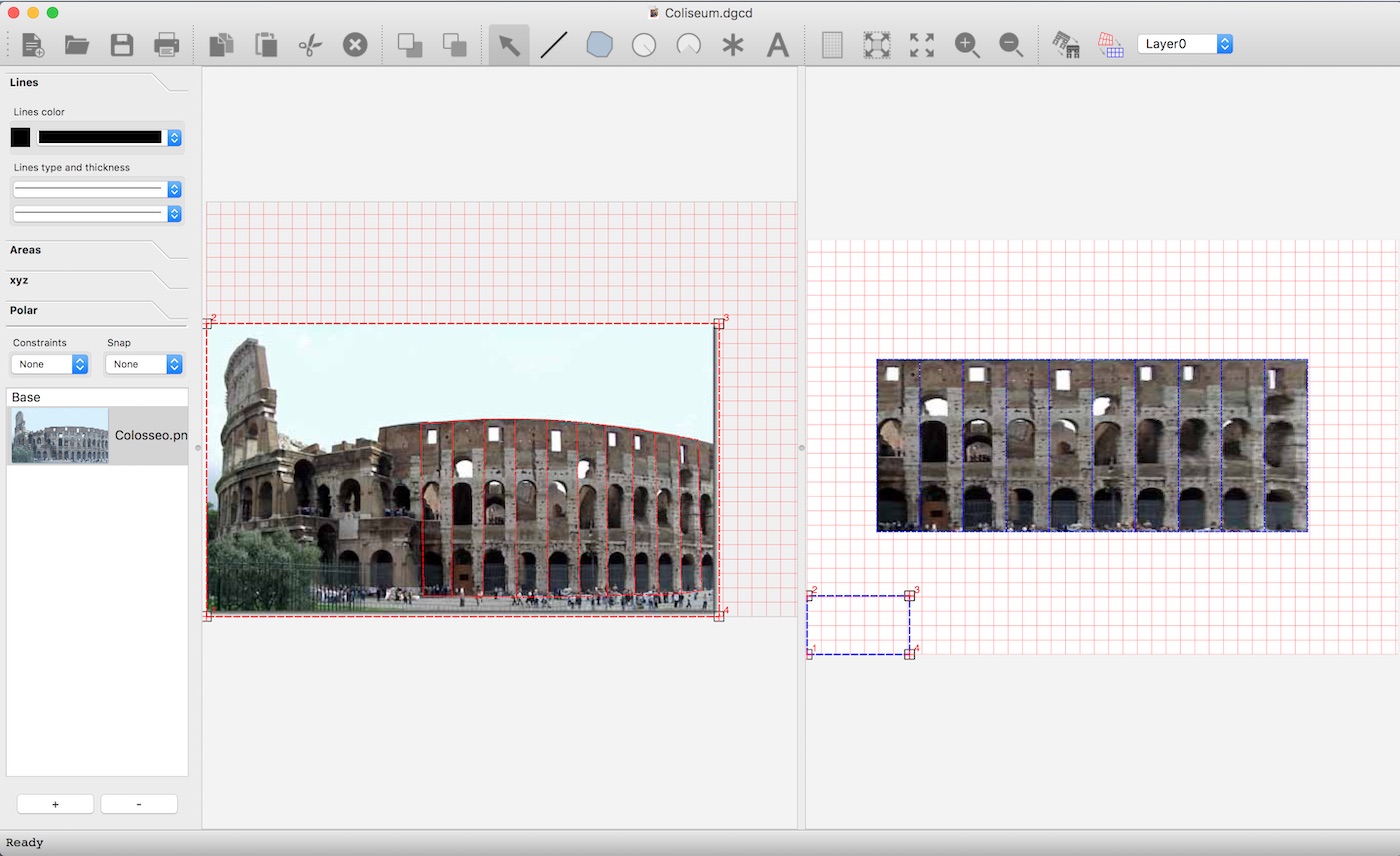
In the previous version of DigiCad 3D both the original elements and those resulting from processing were positioned on the same worksheet, while now the two parts are separate: an origin view, where to place images, photos and drawings to be processed, and a destination view , where the results of the linear and perspective transformation processing normally appear.
Everything is managed via origin layers and destination layers.
Origin layers are normally associated with images.
Contrary to the previous version, where each document could have a maximum of 4 attachment points and a mesh, now each origin layer can be associated with origin and destination attach points and meshes, in order to better manage jobs with multiple images such as architectural or photogrammetric mosaics.
The inspection panel allows you to interact with the various graphic parameters and to introduce and modify the elements also numerically.
Here is an incomplete list of differences from DigiCad 3D 9.
- WIndows and MacOs multiplatform system with common job format based on QT
- Splitting the program window into the Origin and Destination views
- Advanced graphical interface with management through “handles”
- Multiple origin layers with attachment points and meshes
- DWG and DXF import and export with images included
- Management of DWG and DXF imports in graphic containers that can be managed as blocks
- Interactive management of transparency, deformation and rotation of images and DWG and DXF groups
- Multiple Undo – Redo without limits
- Multi-document management
- Creation of cutouts and transparencies of parts of images by drawing vector shapes
- Automatic vectorization of images
- Interactive management of the optical deformation of the lenses
- Multi-page print preview
- Many import and export formats, including PDF
DigiCad 3D key features
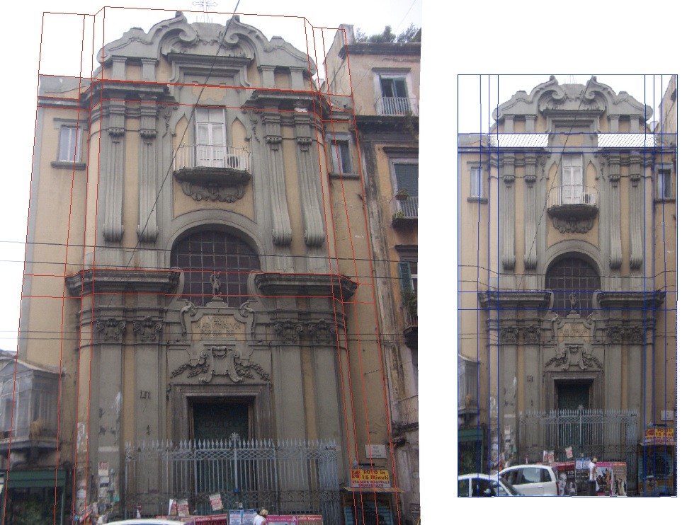
- Architectural elevations from photographs
- Elimination of perspective distortion
- Partial transformation
- Mosaic work
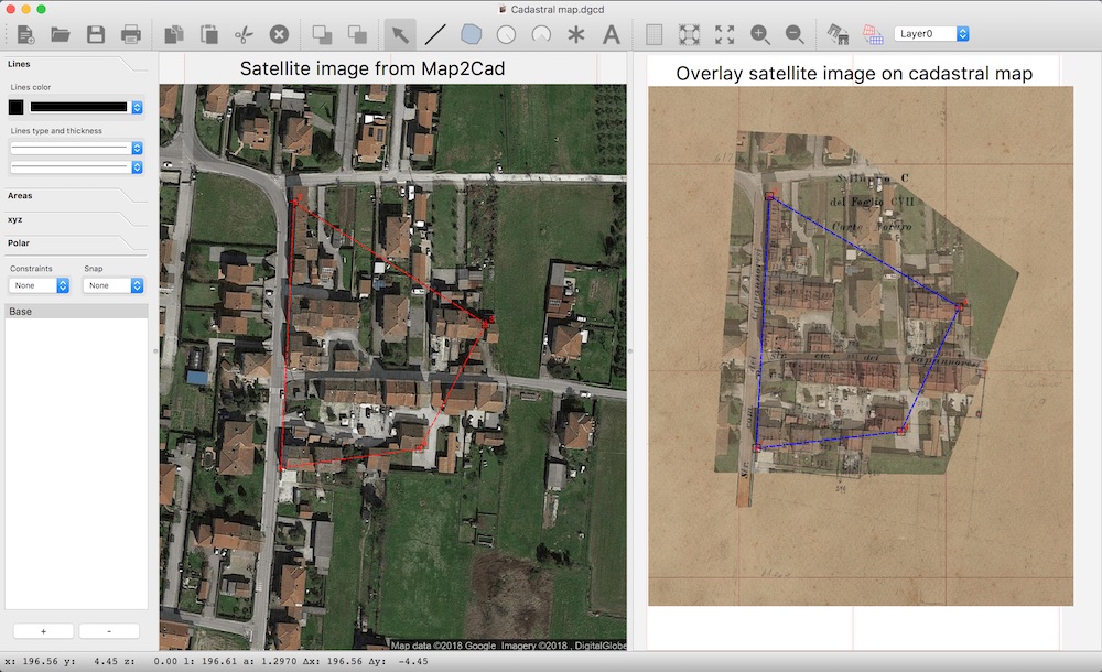
- Transparent images can be superimposed on technical drawings and bitmaps
- Regular- or irregularly curved surfaces can be straightened out
- Optical deformation caused by photo lenses can be eliminated
- Approximate and precise transformation
- Perspective and Linear Transformation
- Ability to work with large format drawings
- Automatic union of parts of drawings
- Direct transformation of photos or scanned images
- Geo-reference
- Elimination of map distortions
- Creation of texture from photos
- Snap and Block functions
- Point Clouds
- Maps from satellite
- Ability to move elements or groups of elements
- Import DWG, DXF, XYZ, JPG, BTM, GIF, JPEG, PNG formats and others format
- Export i DWG, DXF, XYZ, PDF, JPG, BTM, GIF, JPEG, PNG, PDF and many others
- Rotation, modification of the transparency, of the resolution and of the number of colors of the raster images
- Exact images re-scale and real measurements.
More …
Some images
