Map2Cad is a module of Domus.Cad Pro and Std, which enables you to import both satellite and road maps from Google Maps.
Maps are imported with actual measurements and represented in the video scale selected in Domus.Cad.
The main features of Map2Cad are:
- Internal browser for viewing maps, with the Google Maps functions integrated
- Import of maps
- Managing a list of maps
- Inserting the maps from the list into Domus.Cad
- Maps are imported with actual measurements
The use of Map2Cad is very simple and allows for the integration of each of the Google maps features in Domus, including search functions, display choices, street view and more.
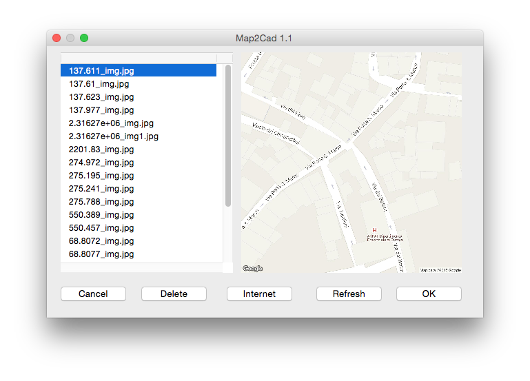
When you choose Map2Cad from the Domus.Cad Modules menu, the following dialog box appears:
On the left, a list of previously imported maps appears.
On the right, the selected map is displayed.
The buttons at the bottom mean the following:
- Cancel: cancels the operation and returns to the main Domus.Cad window.
- Delete: removes the selected map from the list.
- Refresh: redraws the selected map.
- OK: the selected map is imported into Domus.Cad
- From the Internet: imports one or more maps from Google Maps and adds them to the list.
Importing from Google Maps
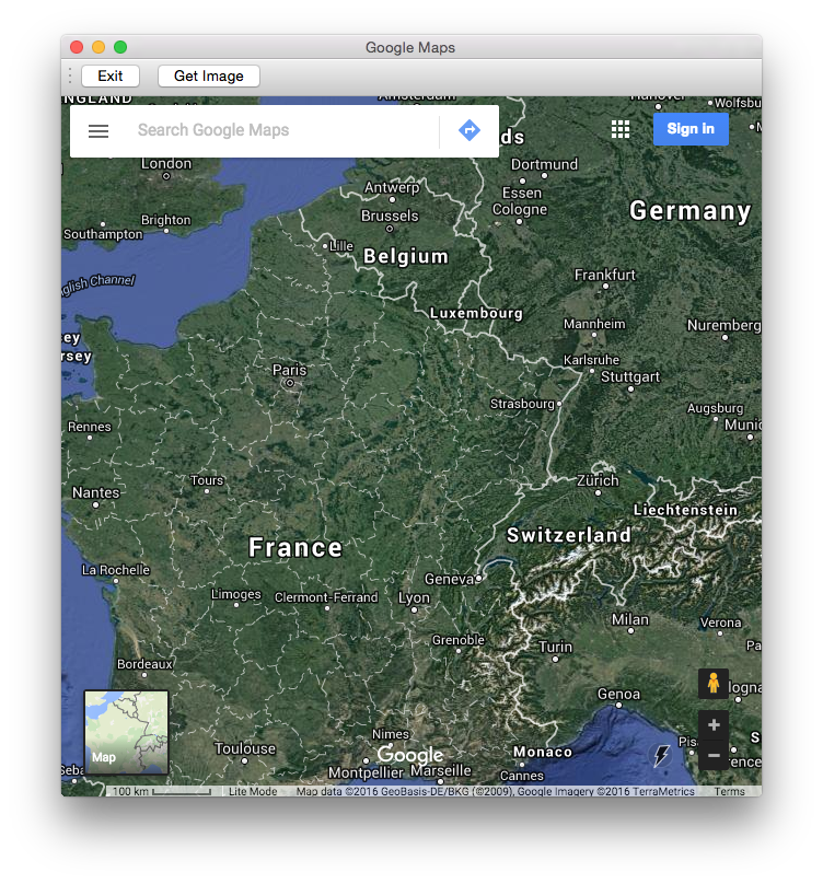
Clicking on the ‘From the Internet’ button opens the navigation window:
Google Maps Navigation Windows
The window allows the main features of Google Maps to operate, including:
- Searching for a location by an address
- Satellite view
- Map view
- Zoom + and –
- Dragging the map with the mouse
- Zoom in and out with the mouse wheel
- Street View
The Image button imports the displayed map and adds it to the list.
The Exit button allows you to return to the previous window.
Importing into Domus.Cad
By clicking on the ‘OK’ button, the selected map is imported in Domus.Cad and placed in the current window.
It can be subsequently moved into the desired position.
As the map features actual measurements, you can take measurements and draw.
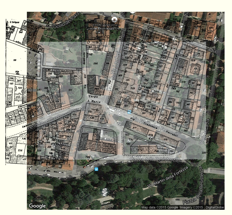
You can change the transparency of the map by means of the PictRot module, in order to superimpose different maps, such as cadastral maps and aerial surveys.
On the imported map with actual measurements, various elements can be detected, such as trees, crops, stone walls, roof texture, and lots of further data.
Caution: Images with very large actual measurements, e.g., a map of Europeor US, may not be able to be displayed to the current video scale, however, by carrying out an Autoscale command which contains the whole image in the current window, it is visible.
Working with Images
Thanks to the actual measurements of the imported maps, the images can easily be used in many ways, here are some suggestions:
- Overlapping with PRG and Cadastre maps to integrate the map information with the satellite image details
- Placement of the project directly on the satellite photo
- Using satellite maps as a mesh texture in order to realise a photo-realistic representation of the terrain
- Preliminary projects drawn directly on the satellite maps
- planimetric and volumetric projects
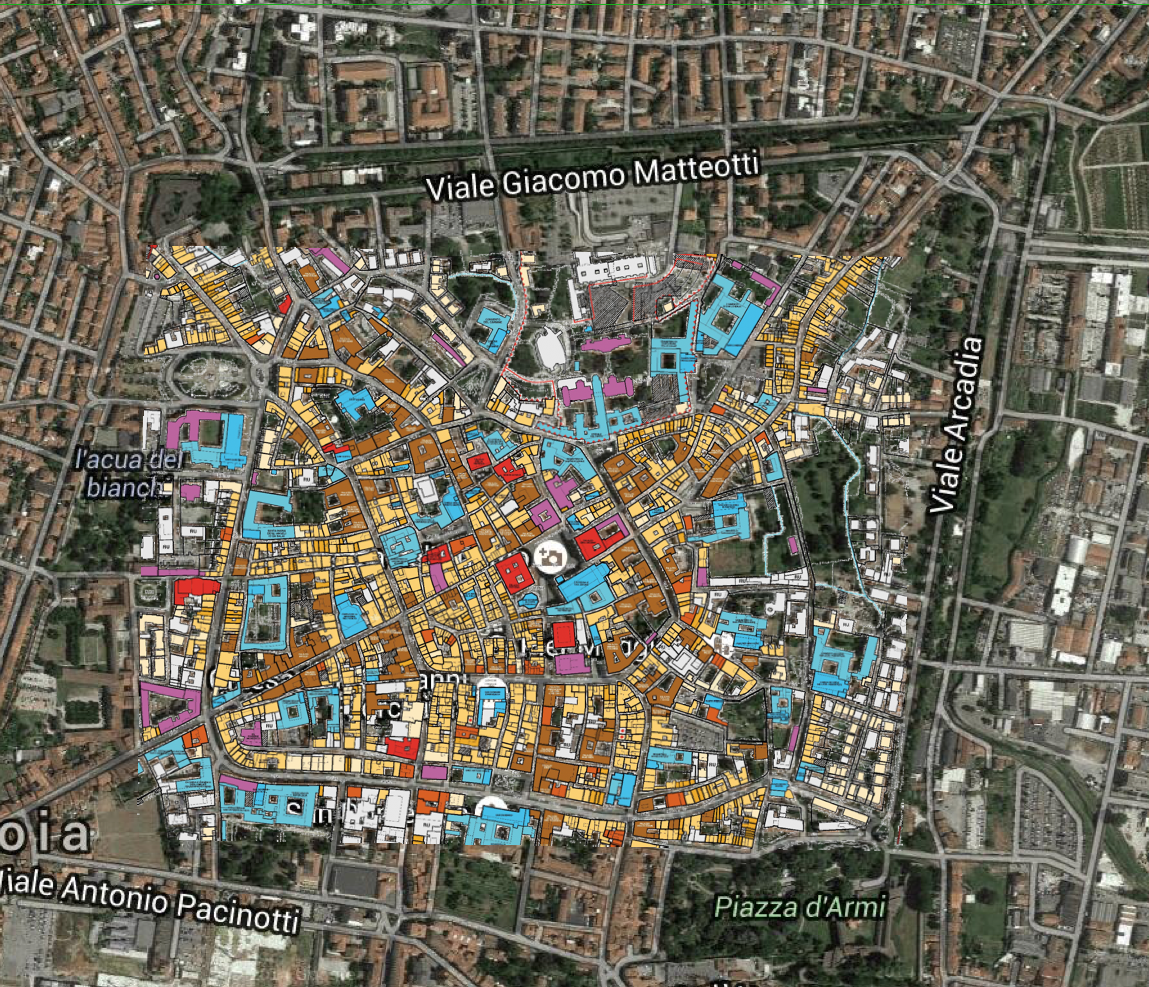
Here are two examples:

Overlaying satellite maps with city map
Overlaying a satellite map with a cadastral map


